
1
/
of
6
All Jigsaw Puzzles
Home Sweet Home UK Hometown Wooden Map Jigsaw Puzzle
Home Sweet Home UK Hometown Wooden Map Jigsaw Puzzle
SKU:JWLR2B2
Regular price
£50.00 GBP
Regular price
Sale price
£50.00 GBP
Unit price
/
per
Tax included.
Shipping calculated at checkout.
Please enter your personalisation details:
Couldn't load pickup availability
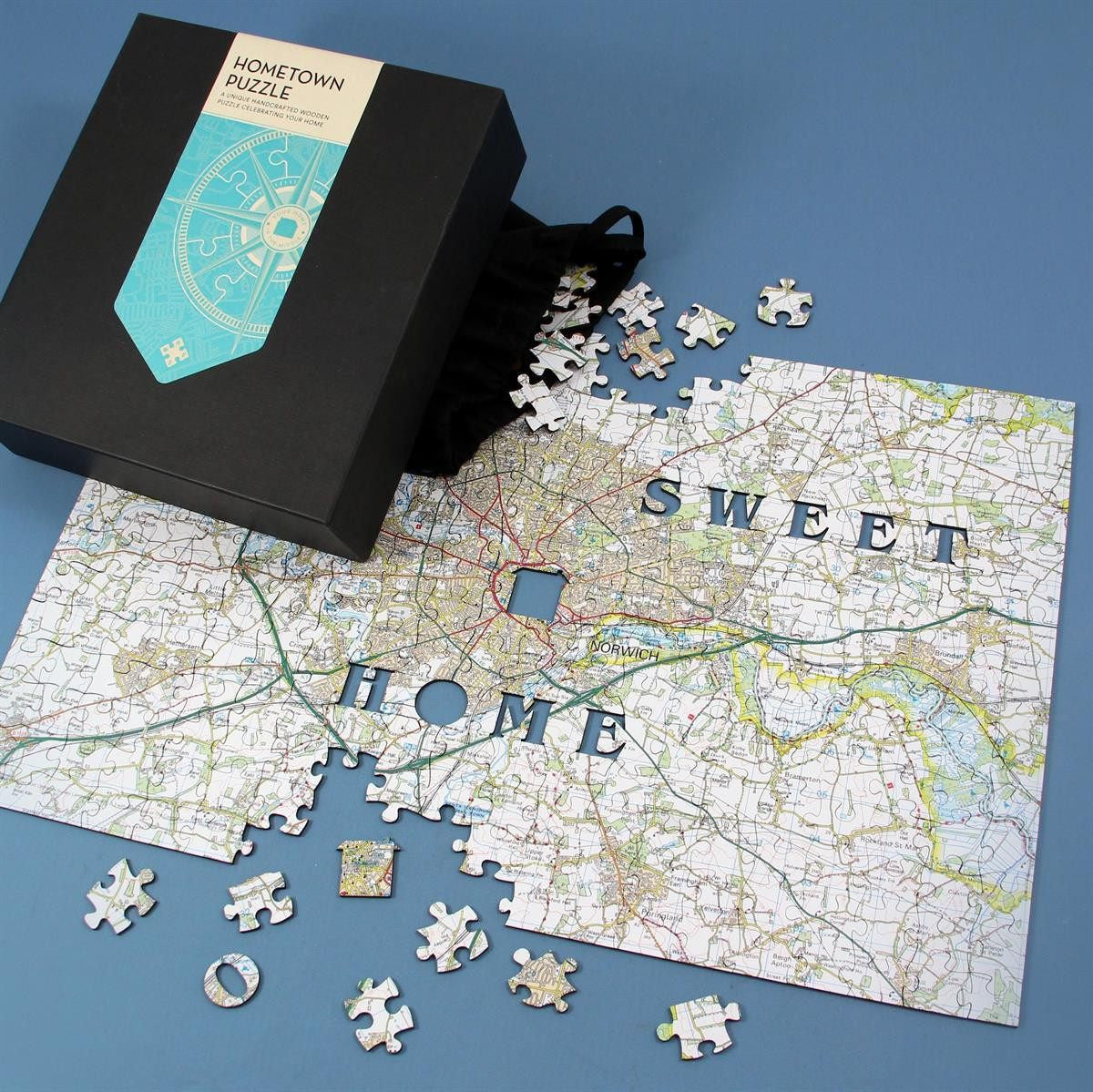
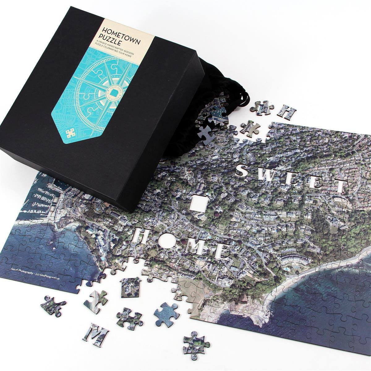
The Wooden Hometown Puzzle is made from premium gloss wood and is the perfect gift to commemorate a special location on a map jigsaw.
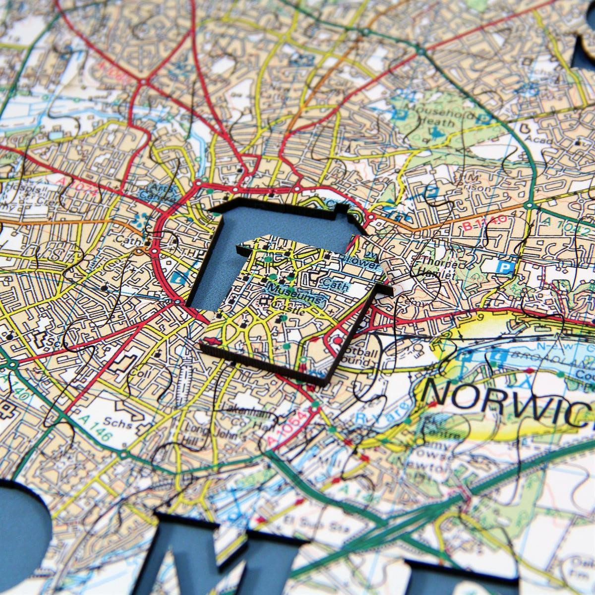
This unique, made to order 300-piece map puzzle is centred on a place of your choice. Simply provide your address and postcode and we will create your individually handcrafted jigsaw puzzle, using 2mm wood. Each jigsaw contains the message 'Home Sweet Home' made from a number of novelty shaped pieces or "whimsies", so called because Victorian Craftsmen - who invented the jigsaw concept during the 19th century - cut unusually shaped pieces "on a whim".
Start with the central house-shaped whimsy and watch your neighbourhood come to life piece by piece as you build your jigsaw.
Delight and impress with this highly original and distinguished gift ensuring hours of pleasure and enjoyment for many years (and generations) to come.
Choose from the following three incredible map bases - UK Topographic, UK Aerial Photography or UK Street Mapping. See below for full details of each map.
Your made-to-order wooden map jigsaw puzzle will have 2mm thick puzzle pieces, which are carefully placed in a drawstring cotton bag within a gorgeous box. A guide print is included to help you piece together your beautifully detailed map jigsaw.
This personalised product is handmade to your personal specification and will usually be delivered within 5 working days.
Puzzle Size:
The completed 300-piece puzzle measures 47 x 30.5cm.
Mapping Base Full Details:
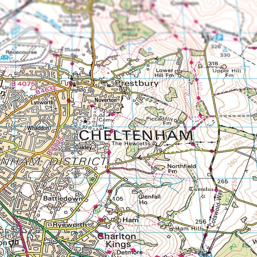
UK Topographic (1:50,000) -
300 Piece Map Shows 14.6 miles East to West and 9.47 miles North to South.
Covers Great Britain, the Isle of Wight, the Shetland Islands, the Orkney Islands and the Hebrides. © Crown copyright and database rights 2025 Ordnance Survey 100054682.
UK Aerial Photography (1:5,000) -
Please note this is a birds eye view, taken from a satellite image.
300 Piece Map Shows 1.46 miles East to West and 0.94 miles North to South.
Covers England, Wales and Scotland, including the Isle of Man, Isle of Wight, the Shetland Islands, the Orkney Islands and the Hebrides. Aerial Imagery for the United Kingdom courtesy of Getmapping Ltd, 2025.
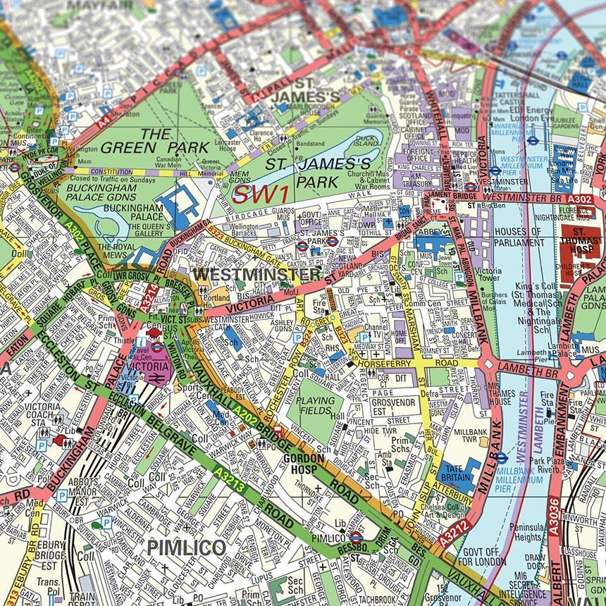
UK Street Mapping (1:14,000) -
300 Piece Map Shows 4.08 miles East to West and 2.65 miles North to South.
Covers England and major cities in Wales and Scotland. Map Data © Crown Copyright and database rights 2025 Ordnance Survey AC0000808974.
Mapping Not Available for Northern Ireland
Share